
|
|
Historic US Highway 60 and California State Route 60.
The History.
|
Defined as one of the original US Highways in 1926, US 60 was originally planned to ran from Chicago to Los Angeles. Another road was already in planning however, running transcontinentally and since route numbers ending in zero were usually set aside for transcontinental routes, the US 60 designation was transferred to that route. Running from Virginia Beach to Los Angeles, it traversed further south of the original route. The Chicago to Los Angeles route was renumbered, becoming the now-infamous US 66. Both routes were finalized at the same time, and defined federally in 1926.
|
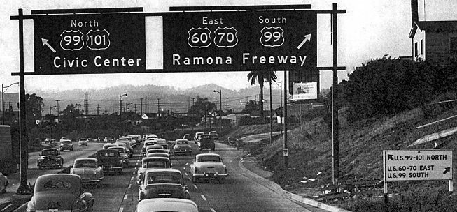
Looking North on US 101/Santa Ana Fwy. Ramona Fwy was renamed San Bernardino Fwy shortly thereafter. Circa 1940's/1950's.
Image courtesy of SoCalRegion.com and AARoads.
|
US 60's western terminus was always to be in Los Angeles, although it was not given actual roadbed until 1929 when the state officially 'welcomed' US 60 in. It crossed the Colorado River into California at Blythe by itself, and traveled through the Mojave Desert roughly along the path of modern I-10. Near Chiriaco Summit, however, it diverted south along Box Canyon into the community of Mecca. It then went north along modern State Route 111 to Coachella, where it met US 99 and the pair continued northwest on Indio Blvd into Palm Springs and eventually into Banning.
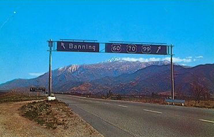
Looking eastbound passed the Banning Interchange. The Banning Exit is most likely for 6th St. Snow capped Mt San Jacinto in the distance.
Image courtesy of SoCalRegion.com and AARoads.
|
At the Banning Interchange, US 60 branched off and took a more southern-lying route through the Inland Empire. The Moreno Valley Interchange brought US 60 and US 395 together through Box Springs Canyon, with US 395 leaving north with US 91 at the Riverside Interchange. This overlap still exists to this day, with US 395 being replaced with I-215 and US 60 and 91 being supplemented with their respective State Routes (SR 60 and SR 91). To this day, it's still the busiest interchange in the Inland Empire. While in some areas for a very short time, US 60 did run along the Pomona and Moreno Valley Freeways east of the modern I-15.
|
|
US 60 continued west along Mission Blvd to modern SR 71 where it headed north, and eventually west again at the modern Kellogg Interchange. The named changed to Ramona Blvd as it traversed eastern Los Angeles County, changing in El Monte to Garvey Ave, and the back to Ramona Blvd as it reached it's terminus in East Los Angeles. US 99's alignment was later changed from being co-routed with US 66 along Foothill Blvd to US 60 along Ramona and Garvey, and in the 1930's US 70 was pushed out to California being co-routed with US 60 for it's entirety through the state. They even shared the same termini in East Los Angeles. It was changed in late 1930's to be routed with US 99 exclusively east of Indio, but remained co-routed with US 60 from Blythe to Indio.
|
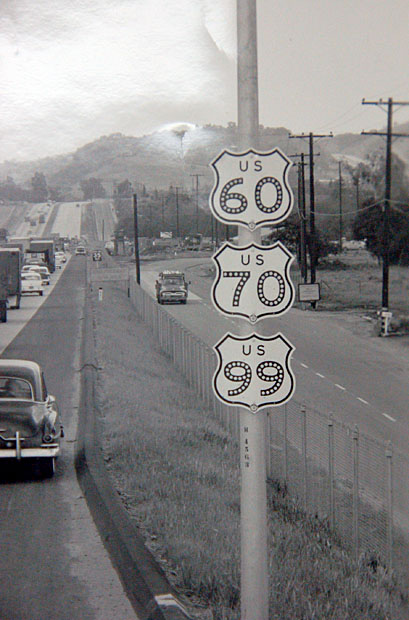
Image courtesy of CalTrans, dated 1957. Thanks to AARoads.
|
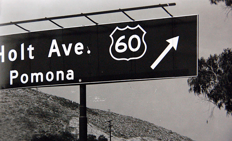
In it's early days, US 60 was signed along Valley Blvd. Valley becomes Holt as it crosses SR 71, where this photo was taken. Image courtesy of CalTrans and AARoads. Dated 1956.
|
Ramona Blvd later became the Ramona Expressway, one of the first limited access highways in the western United States. Tentatively called a freeway, it's still widely debated to this day if wether the Ramona Expressway or the Arroyo Seco Parkway was the first 'freeway' in the western US. The Ramona Expressway was later upgraded to the final accepted specifications of a freeway and changed names to the Ramona Freeway. Following California's later freeway naming convention of naming the freeway of major cities they run though (Hollywood Freeway, Santa Monica Freeway, etc) and the extension of the freeway, the Ramona Freeway changed names to the San Bernardino Freeway. Prior to the completion of the Ramona Freeway, US 60 took a surface street route, Valley Blvd, through Walnut, Industry, and El Monte before intersecting with US 70 and 99. US 60 continued on Valley through Alhambra into East Los Angeles before ending as US 101.
|
Today, US 60 has been replaced by I-10 from Blythe to Banning and Pomona to Los Angeles, and with State Route 60 from Banning to Los Angeles.
The Travel Logs.
Follow us along as we traverse old US 60 and modern State Route 60!
|
Photo Essays:
|
